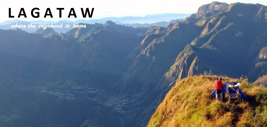
 |
| Kabayan Cantral |
Stats
Covered Distance on foot | 38.1km |
Moving Time | 10 hrs 38mins |
Total Ascent / Elevation Gain | 9117 feet |
Max elevation | 9633 fasl |
Pacing | Moderate to Fast |
Load | Day pack |
For the third time this year, I traversed the route from Akiki to Ambangeg. This was supposed to be our training for the Skyrace on November 26 (which has been moved to February next year). The skyrun is supposed to be a 33-km out-and-back trek and run in Mt Ugo. The longest I had run was 21-km and the two had an 11-km under their belts. The initial plan was a Luzon 3-2-1 (Timbak-Tabayoc-Pulag) expedition but with limited budget and time we settled for a Mt Timbak- Mt Pulag expedition.
It was the first time my two buddies Kevin and (Daniel) Buyco would be able to set foot on Baguio and the famous Mt Pulag so they were both excited. They were so excited that they opposed my proposal to just put off the training climb since the race had been moved to a later date. They said they had been preparing for the climb and that they might spend their budget on other stuff if the climb should be postponed. So we headed for Benguet.
OUR PACKS
 |
| The Columbia Mobex |
We carried only daypacks. I and Kevin used our Columbia Mobex and Buyco used his Conquer daypack. We distributed the components of the tent among ourselves—the body with me, the flysheet with Kevin and the metal parts (pegs and poles) in Buyco’s side pockets.
In my Mobex were:
- one set of clothes and an extra shirt
- my kikay kit
- handheld GPS device
- camera
- food (a can of luncheon meat; 2 cans of San Marino corned tuna; a pack of Quaker oat cookies; milk (in a 330-ml carton); a pack of hopia; 2 packs of pineapple tidbits
- flip-flops
- shades
- sleeping bag
- medicine kit
- the body of my tent
Yep, minimalist! We wanted to be back in Manila on Sunday. And that’s one of the lessons my two protégés learned that day—Duration = Load and vice versa. If you’re expecting a 3-day-2-night journey over the Akiki-Ambangeg trail then you’ll have to bring a heavy tall pack; reciprocally, if you bring a heavy pack your journey will be lengthened. The thing with bringing a heavy pack is you’ll be agonizingly carrying that burden throughout the journey for a long time. Small light packs on the other hand, will give you comfort and will save you a lot of time. I only bring a big backpack if my goal is to enjoy the length of the journey—that is, if I want to have sinigang at the campsite, witness the sunrise/sunset and enjoy one day not walking. To meet these goals will entail bringing more stuff like cook set and stove and butane gas canisters. A longer stay means more food and more clothes, so I’ll really need some extra space for my extra stuff. But if my goal is just to reach the summit, I’ll do it on a day’s hike with a small pack. Tall packs do help you be self-contained. But a daypack is never a big impediment to being self-contained. It is just the way you plan your itinerary. And my buddies just saw how an Akiki-Ambangeg trek in Mt Pulag can be accomplished in less than ten hours with small light packs.
The big question probably is how we were able to do away with stoves, cook sets and butane gas on a journey many consider a major climb. Well, this required knowledge and experience of the place. I had actually already done the same journey before. There were just a few changes in the itinerary. This knowledge helped me polish my itinerary. The same knowledge also helped my friend Dennis Hisanan accomplish the same feat recently. I know that Timbak can be traversed in four hours and Akiki-Ambangeg in 5-7 hours. Between the two mountains there is a town center where you can eat one meal and have another meal to-go. In the same town center, you can get a room for P200. We could actually have left our tent in Manila but the two wanted to experience camping within the Mt Pulag National Park. For more details check our itinerary.
Our Transportation
 |
| Victory Liner Terminal in Baguio |
We took the Genesis bus which was so cramped my shoe could barely fit in the gap between my seat and the backrest of the seat in front of me. It’s just 20 pesos cheaper than the reliable Victory Liner.
Now, the biggest problem for most hikers travelling in small numbers is the transportation from Baguio to Mt Pulag. Y’see the monster jeepneys that can negotiate with the rough roads at Ambangeg can be chartered for a hefty 8 thousand to 10 thousand pesos. Splitting this price among three members of a climbing team is insanity. But my experience and familiarity of the Benguet highlands have taught me that the best route to Mt Pulag for a real hiker (not just a tourist or a photographer) is through Mt Timbak. This is very economical and convenient. You just have to have endurance and the zeal to enjoy the scenery while trekking.
The Timbak-Akiki Route
 |
| Red : Halsema Highway; Orange and Brown: Beckel-Daclan; Yellow: our trek |
The traditional game plan to penetrate Mt Pulag is to gather more than ten people and charter a monster jeepney that will take the group from Baguio City to the DENR station and then to either the jump-off of the Akiki trail or the Ambangeg ranger station. The thing with this game plan is that it is only budget-friendly to those who travel in groups (especially to the organizer). This logistical constraint necessitated me to find another route to Mt Pulag that eliminates the hassle of chartering a jeepney. And with my hands-on familiarity of the Kabayan landscape, I found a route that is friendly to the solo trekker. This route starts at KM 55 of the Halsema Highway and traverses Mt Timbak from west to east down to Kabayan Barrio and on to the Akiki trail.
From Baguio, take any bus that plies the paved Halsema Highway. You can find a lot of these at the Slaughter terminal. For a trekker who would rather walk a mile than pound his bottoms and shower in the dust, this 2-hour ride on a paved highway is definitely better than the 4-hour dusty bumpy ride through the Itogon-Bokod-Ambangeg road. The trade-off is that you’ll have to trek longer. And this 30-km trek is on the steep slopes of Mt Timbak and Akiki trail. You double this distance if you back track and decide not to exit at Ambangeg. Here’s a comparative analysis of the two routes—Baguio-Halsema-Timbak–Akiki and the traditional Baguio-Beckel-(Ambangeg) Daclan.
Halsema-Timbak-Akiki (light pack; few members) | Beckel-Ambangeg (heavy pack; many members) |
2-hour smooth ride on paved highway from Baguio to KM 55 ð 2-hour smooth ride | 4-hour bumpy dusty ride from Baguio to DENR + 2-hour bumpier/dustier ride from DENR to ranger station (or + 1.5-hour dusty ride from DENR to Akiki Jumpoff) ð 5.5 / 6-hour rough ride |
- 1-hour assault on concrete from KM 55 to Mongoto School - 10-minute trek on level ground from Mongoto to Timbak mummies - 2-hour steep descent from Timbak mummies to Tinongchol burial rock - 20-minute descent from Tinongchol to Kabayan Barrio - 50-minute trek from Kabayan Barrio to Kabayan Central (check out Opdas burial cave) - 50-minute trek From Kabayan Central to Akiki Jumpoff - 50-minute descent from Akiki Jumpoff to Eddet River - 4-hour assault from Eddet River to Pulag summit ð 10 hours of knee-breaking walk | - 2 hour smooth trek from Ranger Station to Mt Pulag summit OR - 1 hour and 20 minutes descent from Akiki Jumpoff to Eddet River - 7-hour assault from Eddet River to Mt Pulag summit ð 2-hour smooth trek (Ambangeg) or ð 8-hour tough trek (Akiki) |
Way back If you’re avoiding the dusty bumpy ride, you can go down Akiki and climb up to Halsema highway. But this will be another 10-hour trek. If you wanna take chances, see if you can hitch a ride at the ranger station. But you’ll have to deal with the bumpy dusty ride. | Way back The same dusty and bumpy ride. |
Sights outside Mt Pulag - Timbak vegetable terraces - Timbak mummies - Tinongchol burial rock - Kabayan Museum - Opdas burial cave | Sights outside Mt Pulag - Daclan Sulfur Springs |
Expenses (Baguio-Pulag-Baguio) - P75: fare Baguio – KM55 - P200: park fees (students get discount) - P1800: (÷ number of participants or P1000 for solo climber) guide fee (Akiki-Amba/Akiki) - P400/pax: hitching rate from Ranger Station to Baguio if you choose to take the Ambangeg exit . For a group of 3pax ð P950 / pax (out and back) ð P1275 / pax (Ambangeg exit) | Expenses (Baguio-Pulag-Baguio) - P8500 (÷ number of participants) Ambangeg-Ambangeg jeepney rent ---------or---------- - P9000 (÷ number of participants) Akiki-Amba/Akiki jeepney rent - P200 park fees - P1800: / 7pax guide fee (Akiki-Amba/Akiki) + P100/excess pax ---------or--------- - P500: / 7pax guide fee (Ambangeg-Ambangeg) + P100/excess pax For a group of 10pax ð P1310 (Akiki-Akiki) ð P1130 (Ambangeg-Ambangeg) |
Trekking Distance 56km Halsema-Pulag-Halsema 38km Halsema-Pulag-Ambangeg Ranger Station | Trekking Distance 21km Ranger Station-Pulag-Ranger Station |
 |
| Daclan Sulfur Spring |
Although it may seem like I am popularizing the Timbak-Pulag route, I am appealing to each trekker to just bypass the summit of Mt Timbak. The owner of the Mini Calvary forbids the entry of visitors into the mini-Calvary. If you wish to summit Mt Timbak, you may head for the towers. They are the ones at the summit. The Mini-Calvary is at a lower elevation. Please be careful not to step on the vegetable plots. Or better yet, just don’t go to the summit. The views are better at Mt Pulag. You may just head straight down to Kabayan Barrio from Mongoto Elementary School.
Itinerary and Track Logs
Waypoints | Time | Elevation (fasl) | Coordinates |
DAY 1: Mt TIMBAK | |||
Baguio; Slaughter terminal; ETD for KM55 | 0630 | 4524 | N 16˚25.249’ E 120˚35.582’ |
Halsema Highway KM 55 | 0900 | 7633 | N 16˚39.353’ E 120˚46.606’ |
Mongoto School | 0944 | 8346 | N 16˚39.605’ E 120˚47.106’ |
Ate Josie | 1007 | 8731 | N 16˚39.357’ E 120˚47.107’ |
Mini Calvary | 1017 | 8894 | N 16˚39.236’ E 120˚47.120’ |
Back at Mongoto School | 1046 | 8346 | N 16˚39.605’ E 120˚47.106’ |
Timbak key keeper | 1110 | 8265 | N 16˚39.029’ E 120˚47.798’ |
Lunch | 1200 | Bought eggs and cooked at the key keeper’s place. He’s got a store and you can use his cooking stuff. Paid him P60 for 3 eggs and some rice. That should include the pay for the use of his utensils that we washed. Don’t pay much. Think of it this way, at restaurants where they’ll cook and wash for you, isn’t P20 for a scrambled egg and a cup of cold rice reasonable? | |
Resume trek | 1230 | Paid another P20/pax to view the mummies. Taking pictures is prohibited. | |
Timbak mummies | 1249 | Forgot to mark the waypoint | |
Tinongchol burial rock | 1436 | 3903 | N 16˚38.057’ E 120˚49.099’ |
Kabayan Barrio | 1455 | 3623 | N 16˚38.076’ E 120˚49.387’ |
Kabayan Central | 1540 | Forgot to mark the waypoint | |
Snack; Buy packed dinner (fried chicken thigh and rice = P60) | 1550 | There are a lot of stores and eateries here. The Kabayan Lodge also has rooms at P200 a night. I spent one night here during my first Timbak-Pulag trek beforeI headed for Akiki Visitor’s Center. At this point you should already be calling the park ranger at the Akiki Visitor’s Center about your arrival. | |
Resume trek | 1620 | Just follow the road to the southeasterly direction. You may opt to drop in at the Opdas Mass Burial Cave along the way. The pay is P20/pax. | |
Akiki Visitor’s Center. Answer the call of nature. Refill trek water bottles. Register. Get a guide. Keep the receipts. You’ll need to show them to the park ranger at Ambangeg if you’re planning on a traverse. | 1712 | 4194 | N 16˚36.601’ E 120˚50.452’ |
Start trek to Eddet River | 1810 | You’ll need your headlamps. | |
Eddet River | 1943 | 4206 | N 16˚36.398’ E 120˚51.909’ |
Dinner; Pitch tents | 2000 | ||
Lights out | 2100 | ||
DAY 2 (Mt PULAG) | |||
Wake up call; Break camp | 0400 | We had a quick and light breakfast. (oat cookies, milk and some bread) | |
Start Trek | 0500 | You won’t need your jacket when you walk. As you move your body will get hot. | |
Cow Country | 0550 | 5678 | N 16˚36.420’ E 120˚52.327’ |
Cow Country bench | 0610 | 6086 | N 16˚36.387’ E 120˚52.448’ |
Helipad | 0647 | 6967 | N 16˚36.241’ E 120˚52.700’ |
Mossy forest water source | 0755 | 8171 | N 16˚36.184’ E 120˚53.112’ |
Mossy forest exit; Dwarf bamboo field | 0835 | 8898 | N 16˚36.154’ E 120˚53.432’ |
Saddle Campsite; Brunch | 0909 | 9179 | N 16˚35.835’ E 120˚53.771’ |
Mt Pulag summit | 1001 | 9625 | N 16˚35.865’ E 120˚53.927’ |
Camp 2 | 1041 | 8916 | N 16˚35.061’ E 120˚54.401’ |
Camp 1 | 1131 | 8463 | N 16˚34.774’ E 120˚53.587’ |
Ranger Station; Lunch | 1207 | 8074 | N 16˚34.330’ E 120˚52.814’ |
ETD of shared monster jeepney for DENR | 1230 | If you’re not lucky to find a group with whom to share a monster jeepney, you may hire a habal-habal (P300) or a monster Jeepney (P2000) to take you to the DENR office. In our case, we just had to pay P400/pax from the Ranger Station all the way to Baguio. | |
DENR (Ambangeg) | 1432 | Inform the Park Superintendent that you went through briefing at the Akiki Visitor’s Center. But when there’s more than seven of you, she’ll tell you off for not going through orientation from her before going into the Mt Pulag National Park. | |
Daclan sulfur springs | 1512 | It’s just a short turn-off from the road to Baguio. This is an undeveloped area where you’ll see a gray pool of boiling sulfuric liquid. | |
ETA Baguio | 1710 | We bought some wet tissue at the 7-Eleven beside the Victory Liner Terminal. We cleaned up and changed at the restrooms of the Terminal | |
ETD for Manila | 1830 | We decided to take Victory Liner on our way back because the ride to Baguio had not been comfortable and reliable with Genesis. | |
ETA Manila | 0030 | ||
 |
| Kevin at the summit |
Genesis bus fare | P432 (P342 / student) |
Baguio – KM 55 bus fare | P75 |
Park and camping fees | P200 |
Guide fee | P1800/3pax = P600 |
Hitching fee | P400 |
Others (food stuff) | ~P500 |
Total | < P2500 |
 |
| Team Lagataw: Me, Kevin and Buyco at the KM 55 entry point |

napaka sarap balikan. at isang linggo ako nanaginip sa lugar na dinaanan natin sir! hehe.
ReplyDelete-kevin
MUCH RESPECT SIR! SALUTE!
ReplyDeleteSir whatever happened to the other one's in your list at the start of this year (amuyao, timbak, northern cross, leyte.benguet, halsema..etc) :-)
ReplyDeleteNawalan na ako nang gana...nakialam ang mga bagyo at mga races kaya nabulilyaso...muntikan na yung amuyao pero every time ready na ako, may bagyong darating. nakalimutan ko...nasa pinas pala ako...hindi pede ibale-wala ang weather conditions sa listahan ng mga factors. Benguet Cross MIGHT happen soon. that's going to be my farewell trip before I leave for leyte and stay there for good by the end of this year.
ReplyDeleteThanks sir adonis at nabanggit ninyo ako sa site nyo. sana makasama ko naman ang team lagataw sa adventure. hehe
ReplyDeleteaww. We were at ranger station at 10:30 AM. you were at Pulag the same day as ours. This was the weekend I went to Maam Gina's place. hehe. anyways. nice. Wishing you well on your upcoming skyrun
ReplyDeleteAnd BTW can i have a contact number at the Akiki visitor center?
ReplyDeleteGood evening sir Adonis. You look so cool!
ReplyDeletesir i want to do this timbak-pulag too.. may i know your email add?
ReplyDeletesend me on kenagsaway@yahoo.com ...
ikaw magiging guide/reference ko for this climb. thanks and more power!
Thanks for visiting lagataw.com! I've already emailed you but for others who want to communicate with me, I use two e-mail addies: adonis_domino.lloren@up.edu.ph and lagata@gmail.com
ReplyDeleteHi sir adonis.. Sir, ask ko lang po kung si mam mering na ang magbibigay ng contact number sa Akiki Visitor's Center pag may gusto pong umakyat using Mt.Timbak traverse to Pulag via Akiki? Planning to do this.. Although initial plan is solo trek, baka magsama ako ng isa pa para may kakwentuhan..:).. thanks much..
Delete-Cory
hi adonis,
ReplyDeletewe are a couple interested to climb mt. pulag, can you pls. email me at marienonie@yahoo.com how we can join a group planning for mt. pulag climb. thanks.
nonie
hi sir..ask ko po ulit..:).. from mt. timbak, pano po way papuntang kabayan barrio? wala pong ligaw from mt. timbak summit to kabayan barrio at may mga bahay po along the way? thanks a lot po..:)
ReplyDelete-Cory
Hi mam Cory...this It might be useful. http://www.lagataw.com/2011/11/mt-timbak-mt-pulag-over-weekend.html?showComment=1329282420865
ReplyDeleteAnd here's the number of the Akiki Visitor's Center 09205434383
thanks a lot po sir.. sir,u think safe pong umakyat mag-isa dito (Timbak to Pulag)? Plan to do a solo trek sana..:).. Thanks..
Delete-Cory
Yep safe in the sense na walang mananakit sayo...Pero as far as guaranteeing your arrival at the desired destinations, I'm not sure. Yung Pulag leg is safe kasi may guide ka...your only problem is getting to Akiki Visitors Center (through Mt Timbak) from KM 55. Please don't hire a guide in Timbak...baka umuso ang guiding...at umuso ang pagchacharge for guideship--> which might result in compulsory guideship. But I know you love adventure so I think you'll do it solo. If you do get lost, just make sure you're following a clear track. This will surely lead you to some houses where you can ask for directions or discover something else that others haven't seen. There is no 'getting lost' in Benguet! There is only Fresh Discoveries!
ReplyDeletewow.. thanks for the advice sir..:).. basta tatandaan ko lang to turn left lagi at dapat tanaw ko yung Kabayan Barrio (as what I've read sa multiply account mo) para di maligaw..:).. This will be my first solo climb..:).. yup probably di ako kukuha ng guide.. i'll ask the locals na lang..:).. Thanks a lot po..:)
Delete-Cory
Hi, Lagataw. Your blog is very informative, and we'll be using your article as our guide. Our group of 7 climbers will do the same Mt. Timbak-Mt. Pulag climb this weekend. I hope that we don't get lost from Mongoto school to Kabayan Central.
ReplyDeleteThanks.
Thanks Noelizm. A Mt Timbak-Mt Pulag expedition is incomparable! I say go for it and don't forget the lessons that Nature and Adventure will teach you along the way.
DeleteSucessfully completed the Mt. Timbak (Atok-Kabayan trails) and Mt. Pulag (Akiki-Ambangeg trails) traverses in 3 days. Medyo naligaw lang kami pababa sa Kabayan, di namin nakita kaagad yung first gate on the left trail, nasayang ang 1.5 hrs na trekking. This twin traverse is only for persons with lots of endurance, not just physically fit. Again, thanks for your helpful guide.
DeleteNow I'm setting my sights on traverses of Mt. Kanlaon, Mt. Apo, Mt. Kitanglad-D2, hehe.
No limits in adventure Noelizm! You juts gotta have the guts to GO! Congrats on your successful Timbak-Pulag trek!
ReplyDeletesir your blog is very inspiring.. im planning to do this Mt. Timbak and Mt. Pulag this year..but sadly i never climb timbak nor the akiki trail of pulag or the pulag itself... so im planning to climb Mt. Timbak this may or early june for exploration/preparation for Mt.Timbak-Mt.Pulag... can u give me some advice sir for Mt. Timbak?..
ReplyDeleteardrian21@gmail.com
thank you sir...
@Adrian
DeleteThanks for visiting my blog!
I just led three guys through the trails of Timbak last weekend. we did this same expedition (Timbak-Pulag). but even though it was already my 7th time to take the traverse route from KM55 to Kabayan Barrio, I still got lost. We wasted around one hour. So here's my final tip:
You won't get lost in Mt Timbak if you just follow the ROAD. it's not a trail. It's a road. The road is paved now from KM55 all the way to The mummies. Then it becomes rough again. From the mummies NEVER use any short cuts until you've reached the major fork. The major fork I'm talking about is the bifurcation of the road into two equally wide roads. Take the LEFT! Only ten meters after the fork you should see the GATE. go through this gate and you can reach Kabayan Barrio if you just follow the road. But this time, you may take short cuts. Remember, use short cuts only after the gate. The short cuts will still lead you to the main road. But in case you get lost, houses are scattered there. You can ask for directions. That is if there is someone in (which is rarely the case). Then for the rest, just follow my IT.
One final tip: Make friends at the campsite of Mt Pulag. You'll need to neghotiate with them to give you a ride from Ranger Station to Baguio. You'll have to pay P500 at the most. If you don't feel like making friends, make sure you're already at the ranger station by 1030am. Take a habal-habal (P250) to DENR. The trip might take an hour or two. At the DENR the last trip to Baguio passes by at 1pm. If you miss this, hitch a ride or spend a night at DENR and take the bus to Baguio the following day!
Good luck!
sir lagataw thank you very much for the advise..thank you again also for the quick response..my plan as of now is for Mt.Timbak only.. then i will return later this yr to do the timbak-pulag route.. the reason is i want to see the best of timbak which you said is the culture and the sunset..and for future reference..
DeleteTama...Timbak has a different allure! Sabi na naman ng isa kong kaibigan last weekend 'Basta, kakaiba ang Timbak. Masarap balik-balikan. It's an indescribable feeling'. Enjoy the place. Take time to notice its unique beauty!
Deletemaraming salamat po sir...early week po ng june ako aakyat pra masmraming budget hehe..ang laking tulong po ng blog nyo at advise nyo po s pagplaplan q po...thank you...
Deletepaulit ulit ko binabasa ito.
ReplyDeleteexcited na ako sir adonis for my timbak-pulag!
last year ko pa ito gustong gawin..
sana lang hindi ako maligaw papunta ng kabayan central.
meron bang mga locals sa trail?
on June 9-10..
thanks sir!
ken
Hi Sir,
ReplyDeleteDo you think foreigners will be subjected to extra charges by the guides and parks?
We are climbers from Malaysia and we are planning to do Luzon 3-2-1 trail.
I'd like to be in contact with you for my preparation. Can I have your email address? Mine is farah_nadiahz@yahoo.com
maraming salamat sir sa pagsama saken kahit hanggang kabayan lng..
ReplyDeleteat sa BMC101 about sa rain cover ng TNF..hehe
nice post sir... i hope to try this in the very near future..
ReplyDeletesir, kaylan mo uli gagawin itong trek? can i join you? im a newbie,haven't climb any mountain yet.
ReplyDeleteshee xoxo